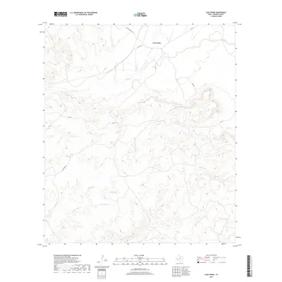
2019 Map of Casa Piedra
USGS Topo · Published 2019About this map
Casa Piedra sits at the northern edge of this Presidio County landscape, where the high desert terrain is defined by a complex drainage system flowing toward the Rio Grande basin. The northern plains, accessed via Rr Track Rd and Cienega Mountain Rd, give way to a rugged network of arroyos and creeks. Principal among these are Alamito Cr and Alamo Cr, which cut through the central portion of the quadrangle. To the south, the terrain becomes increasingly intricate as Holguin Cr and White Spring Cr carve through the foothills. A vital water source in this arid environment is White Spring, located near the headwaters of its namesake creek. The modern transport network, including Hwy 169 and Casa Piedra Rd, follows the natural contours established by these ancient waterways.
Find a feature on this map
12 named features on this map. Tap any name to fly to it.
Don’t see what you’re looking for? This feature index may not catch every label — zoom into the map to look around manually.
Map Details
Editions of this 2019 Casa Piedra Map
This is the sole edition of this map. No revisions or reprints were ever made.
Other maps of this area

1896 · Shafter
USGS Topo · 1:125,000

1917 · Tascotal Mesa
USGS Topo · 1:62,500

1918 · Jordan Gap
USGS Topo · 1:62,500

1930 · Jordan Gap
USGS Topo · 1:62,500

1944 · Tascotal Mesa
USGS Topo · 1:62,500

1959 · Emory Peak
USGS Topo · 1:250,000

1959 · Presidio
USGS Topo · 1:250,000

1965 · Presidio
USGS Topo · 1:250,000

1965 · Emory Peak
USGS Topo · 1:250,000

1983 · Plata
USGS Topo · 1:24,000