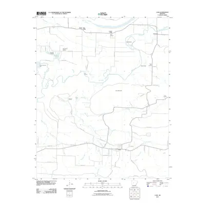
2011 Map of Casa
USGS Topo · Published 2011About this map
Casa serves as a central hub in this rural landscape, where the southern terrain is defined by the winding paths of Big Creek and Grace Creek. To the north, the Petit Jean River meanders through a valley marked by distinct landforms like Sadler Bend and Bryant Cove. This geography shaped the settlement patterns of small communities such as New Neely, Cotton Town, and Slaty Crossing. Genealogists will find a high concentration of burial sites, including the Slaty Crossing Catholic Cemetery, Bata Mill Cemetery, and Needmore Cemetery. The map also details early 21st-century infrastructure, featuring landmarks like the Kingfisher Lake Dam and Pond Creek Lake Dam. The presence of several named coves and mountain ridges indicates a landscape where agriculture and community centers were closely tied to the natural drainage systems of the Fourche region.
Find a feature on this map
63 named features on this map. Tap any name to fly to it.
Don’t see what you’re looking for? This feature index may not catch every label — zoom into the map to look around manually.
Map Details
Editions of this 2011 Casa Map
This is the sole edition of this map. No revisions or reprints were ever made.
Other maps of this area

1888 · Dardanelle #4
USGS Topo · 1:62,500

1889 · Morrilton No. 3
USGS Topo · 1:62,500

1890 · Benton
USGS Topo · 1:125,000

1890 · Hot Springs
USGS Topo · 1:125,000

1890 · Dardanelle
USGS Topo · 1:125,000

1892 · Morrillton
USGS Topo · 1:125,000

1894 · Morrillton
USGS Topo · 1:125,000

1894 · Hot Springs
USGS Topo · 1:125,000

1894 · Benton
USGS Topo · 1:125,000

1955 · Little Rock
USGS Topo · 1:250,000