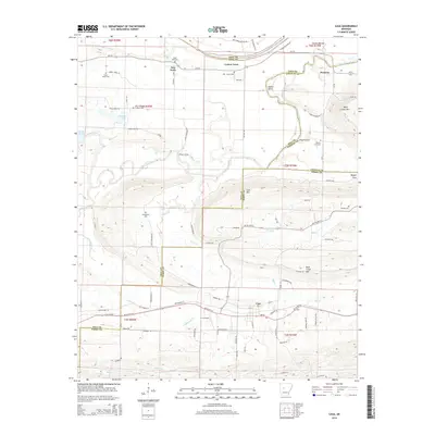
2014 Map of Casa
USGS Topo · Published 2014About this map
The Petit Jean River anchors this central Arkansas landscape, carving a wide valley as it flows past the northern face of Petit Jean Mtn and Cove Mtn. This 2014 survey captures a rural landscape where county lines for Pope, Yell, Conway, and Perry counties converge near Sadler Bend. The settlement of Casa sits at the intersection of AR 10 Highway W and AR 155 Highway N, serving as a local hub south of the river. Small, established communities like Cotton Town, New Neely, and Pontoon are scattered across the lowlands, often identified by family-named cemeteries such as Bata Mill Cem and Harris Cem. The terrain rises sharply to the south, dominated by Rose Creek Mtn, which overlooks the winding courses of Rose Creek and Big Creek.
Find a feature on this map
85 named features on this map. Tap any name to fly to it.
Don’t see what you’re looking for? This feature index may not catch every label — zoom into the map to look around manually.
Map Details
Editions of this 2014 Casa Map
This is the sole edition of this map. No revisions or reprints were ever made.
Other maps of this area

1888 · Dardanelle #4
USGS Topo · 1:62,500

1889 · Morrilton No. 3
USGS Topo · 1:62,500

1890 · Benton
USGS Topo · 1:125,000

1890 · Hot Springs
USGS Topo · 1:125,000

1890 · Dardanelle
USGS Topo · 1:125,000

1892 · Morrillton
USGS Topo · 1:125,000

1894 · Morrillton
USGS Topo · 1:125,000

1894 · Hot Springs
USGS Topo · 1:125,000

1894 · Benton
USGS Topo · 1:125,000

1955 · Little Rock
USGS Topo · 1:250,000