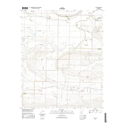
2017 Map of Casa
USGS Topo · Published 2017About this map
The Petit Jean River carves a winding path across this portion of central Arkansas, defining the geography between the northern slopes of Petit Jean Mtn and the southern reaches of Pope County. Near the river's horseshoe bend at Sadler Bend, small rural communities such as Cotton Town and Pontoon occupy the lowlands. The map reveals a high concentration of family and community burial sites, including the Bata Mill Cem and Slaty Crossing Catholic Cem, which point to a long-established rural population. To the south, the terrain rises toward Cove Mtn and Rose Creek Mtn, where the landscape transitions from the river valley's agricultural plots to the more elevated ridges near the town of Casa. Numerous creeks, such as Rose Cr and Hambright Cr, drain these highlands, creating a complex network of timbered hollows and small-scale homesteads.
Find a feature on this map
72 named features on this map. Tap any name to fly to it.
Don’t see what you’re looking for? This feature index may not catch every label — zoom into the map to look around manually.
Map Details
Editions of this 2017 Casa Map
This is the sole edition of this map. No revisions or reprints were ever made.
Other maps of this area

1888 · Dardanelle #4
USGS Topo · 1:62,500

1889 · Morrilton No. 3
USGS Topo · 1:62,500

1890 · Benton
USGS Topo · 1:125,000

1890 · Hot Springs
USGS Topo · 1:125,000

1890 · Dardanelle
USGS Topo · 1:125,000

1892 · Morrillton
USGS Topo · 1:125,000

1894 · Morrillton
USGS Topo · 1:125,000

1894 · Hot Springs
USGS Topo · 1:125,000

1894 · Benton
USGS Topo · 1:125,000

1955 · Little Rock
USGS Topo · 1:250,000