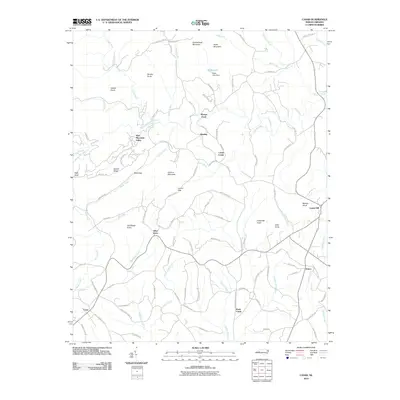
2010 Map of Casar
USGS Topo · Published 2010About this map
Carpenter Knob and Buffalo Knob anchor this landscape of the South Mountains foothills, where small rural settlements are linked by a winding network of named local roads. The village of Casar lies in the southwest corner, while other longstanding community centers like Toluca, Olive Grove, and Ramsey are scattered throughout the territory. This 2010 survey illustrates a region defined by its hydrography, with the Little River and Jacob Fork carving paths through the terrain. Notable local landmarks include Shoups Ford, Willis Lake, and several named gaps and ridges such as Leman Gap and Gilead Ridge. The intricate road system, including Dirty Ankle Rd and Heavens Way, suggests a deeply rooted local geography where family and place-names persist across the ridges of Noah Mountain and Queens Mountain.
Find a feature on this map
99 named features on this map. Tap any name to fly to it.
Don’t see what you’re looking for? This feature index may not catch every label — zoom into the map to look around manually.
Map Details
Editions of this 2010 Casar Map
This is the sole edition of this map. No revisions or reprints were ever made.
Other maps of this area

1895 · Hickory
USGS Topo · 1:125,000

1905 · Morganton
USGS Topo · 1:125,000

1909 · Lincolnton
USGS Topo · 1:62,500

1911 · Lincolnton
USGS Topo · 1:62,500

1950 · Shelby
USGS Topo · 1:62,500

1953 · Charlotte
USGS Topo · 1:250,000

1954 · Charlotte
USGS Topo · 1:250,000

1956 · Valdese
USGS Topo · 1:24,000

1956 · Benn Knob
USGS Topo · 1:24,000

1956 · Casar
USGS Topo · 1:24,000