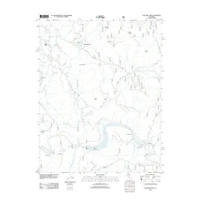
2012 Map of Cascadel Point
USGS Topo · Published 2012About this map
Redinger Lake and the San Joaquin River dominate this terrain on the Fresno-Madera county line, where hydroelectric infrastructure and small mountain settlements define the landscape. The map details the local power industry, identifying the Powerhouse Number One A and various intake structures near Corrine Lake. Settlement patterns are concentrated around Cascadel Woods and Cascadel Point, reflecting the transition from agricultural roots at Cascadel Ranch to modern mountain residential life. In the southern portion of the sheet, the small community of Lerona sits near the winding paths of Italian Cr and Jose Cr. The geography is further marked by colorful local nomenclature, including Whisky Ridge, Mormon Hill, and the historic Italian Bar along the river, providing a clear record of the area's mixed heritage of ranching, mining, and utility development.
Find a feature on this map
42 named features on this map. Tap any name to fly to it.
Don’t see what you’re looking for? This feature index may not catch every label — zoom into the map to look around manually.
Map Details
Editions of this 2012 Cascadel Point Map
This is the sole edition of this map. No revisions or reprints were ever made.
Other maps of this area

1904 · Kaiser
USGS Topo · 1:125,000

1912 · Mariposa
USGS Topo · 1:125,000

1942 · Millerton Lake
USGS Topo · 1:62,500

1945 · Millerton Lake
USGS Topo · 1:62,500

1947 · Mariposa
USGS Topo · 1:250,000

1948 · Mariposa
USGS Topo · 1:250,000
1953 · Bass Lake
USGS Topo · 1:62,500

1953 · Shaver Lake
USGS Topo · 1:62,500

1953 · Shuteye Peak
USGS Topo · 1:62,500

1957 · Mariposa
USGS Topo · 1:250,000