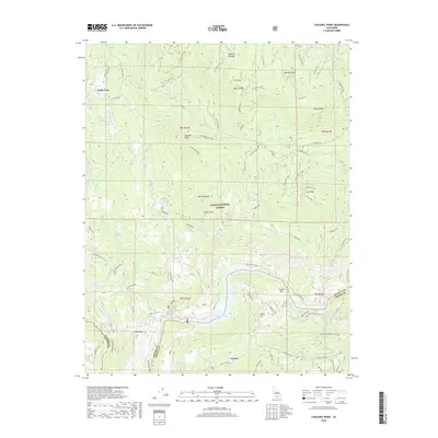
2018 Map of Cascadel Point
USGS Topo · Published 2018About this map
Redinger Lake dominates the southern reaches of this Sierra Nevada landscape, where the San Joaquin River defines the border between Madera and Fresno counties. The settlement of Lerona sits south of the water, while the northern terrain is characterized by the complex drainage systems of Whisky Creek and South Fork Willow Creek. Historical land use is evident in the presence of an Indian Allotment and the named spur roads like Peckinpah and Cascadel that penetrate the high country.
Find a feature on this map
77 named features on this map. Tap any name to fly to it.
Don’t see what you’re looking for? This feature index may not catch every label — zoom into the map to look around manually.
Map Details
Editions of this 2018 Cascadel Point Map
This is the sole edition of this map. No revisions or reprints were ever made.
Other maps of this area

1904 · Kaiser
USGS Topo · 1:125,000

1912 · Mariposa
USGS Topo · 1:125,000

1942 · Millerton Lake
USGS Topo · 1:62,500

1945 · Millerton Lake
USGS Topo · 1:62,500

1947 · Mariposa
USGS Topo · 1:250,000

1948 · Mariposa
USGS Topo · 1:250,000
1953 · Bass Lake
USGS Topo · 1:62,500

1953 · Shaver Lake
USGS Topo · 1:62,500

1953 · Shuteye Peak
USGS Topo · 1:62,500

1957 · Mariposa
USGS Topo · 1:250,000