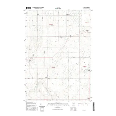
2015 Map of Casco
USGS Topo · Published 2015About this map
Casco and its surrounding dairy-country settlements anchor this 2015 survey of Kewaunee County. The landscape is defined by the headwaters of the Kewaunee River and numerous small drainages like Rio Cr and Mashek Cr. Local history is preserved in several rural religious sites, including Holy Trinity Cem and Saint Adalberts Cem in Slovan. The map details the village of Rio Creek and smaller hamlets such as Euren, Gregorville, and Rankin. Notable for outdoor recreation and conservation, the Ice Age National Scenic Trail winds through the southwestern corner of the quadrangle, tracing the glacial topography near Clyde. Agricultural aviation is represented by Walter's Agri-Center Airport near the center of the sheet, while the twin basins of East and West Alaska Lake sit on the eastern edge. This record captures the established road network and rural character of the region in the early 21st century.
Find a feature on this map
94 named features on this map. Tap any name to fly to it.
Don’t see what you’re looking for? This feature index may not catch every label — zoom into the map to look around manually.
Map Details
Editions of this 2015 Casco Map
This is the sole edition of this map. No revisions or reprints were ever made.
Other maps of this area

1952 · Casco
USGS Topo · 1:62,500

1954 · Kewaunee
USGS Topo · 1:62,500

1954 · Manitowoc
USGS Topo · 1:250,000

1958 · Manitowoc
USGS Topo · 1:250,000

1960 · Algoma
USGS Topo · 1:62,500

1978 · Casco
USGS Topo · 1:24,000

1978 · Namur
USGS Topo · 1:24,000

1978 · Stangelville
USGS Topo · 1:24,000
1978 · Luxemburg
USGS Topo · 1:24,000

1978 · Brussels
USGS Topo · 1:24,000