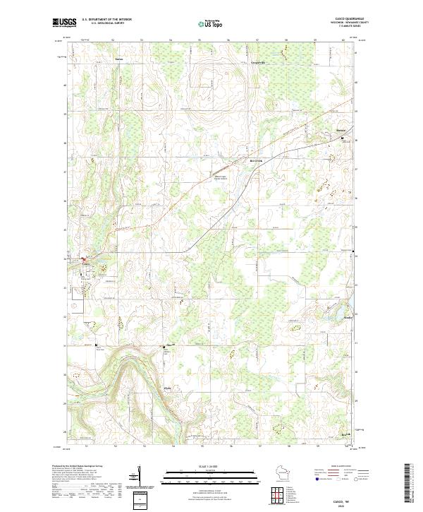
2022 Map of Casco
USGS Topo · Published 2022About this map
Casco serves as a central hub for this portion of Kewaunee County, situated where the Ahnapée State Trl meets the waters of Casco Cr and the Casco Millpond. The landscape is a patchwork of agricultural sections and scattered settlements like Slovan, Rio Creek, and Rankin, reflecting a rural Wisconsin character that has persisted for generations. A significant wetland feature, the Black Ash Swamp, occupies the northern reaches near Gregorville, while the Kewaunee River winds through the southern terrain past Clyde. Local family and religious history is preserved in numerous burial grounds, including the Saint Johns Cem and Saint Adalbert Cem. The presence of the Walter's Agri-Center Airport amidst these traditional farmsteads highlights the ongoing intersection of modern transport and agricultural commerce.
Find a feature on this map
92 named features on this map. Tap any name to fly to it.
Don’t see what you’re looking for? This feature index may not catch every label — zoom into the map to look around manually.
Map Details
Editions of this 2022 Casco Map
This is the sole edition of this map. No revisions or reprints were ever made.
Other maps of this area

1952 · Casco
USGS Topo · 1:62,500

1954 · Kewaunee
USGS Topo · 1:62,500

1954 · Manitowoc
USGS Topo · 1:250,000

1958 · Manitowoc
USGS Topo · 1:250,000

1960 · Algoma
USGS Topo · 1:62,500

1978 · Casco
USGS Topo · 1:24,000

1978 · Namur
USGS Topo · 1:24,000

1978 · Stangelville
USGS Topo · 1:24,000
1978 · Luxemburg
USGS Topo · 1:24,000

1978 · Brussels
USGS Topo · 1:24,000