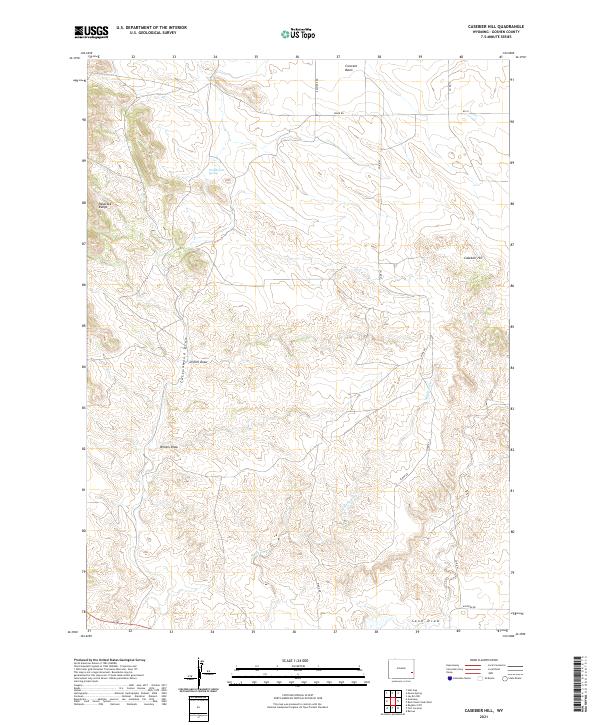
2021 Map of Casebier Hill
USGS Topo · Published 2021About this map
Casebier Hill rises as a prominent landmark in this portion of Goshen County, overlooking a landscape defined by seasonal drainages and high plains. The topography is shaped by significant dry-wash systems, including the long reach of Cottonwood Draw and the branching paths of Divinie Draw and Britain Draw. These features demonstrate the hydrologic patterns of the region, where water movement is channeled through distinct depressions toward larger basins like Crescent Basin to the north.
Find a feature on this map
20 named features on this map. Tap any name to fly to it.
Don’t see what you’re looking for? This feature index may not catch every label — zoom into the map to look around manually.
Map Details
Editions of this 2021 Casebier Hill Map
This is the sole edition of this map. No revisions or reprints were ever made.
Other maps of this area

1896 · Patrick
USGS Topo · 1:125,000

1896 · Hartville
USGS Topo · 1:125,000

1901 · Hartville
USGS Topo · 1:125,000

1950 · Guernsey
USGS Topo · 1:24,000

1950 · Casebier Hill
USGS Topo · 1:24,000

1950 · Fort Laramie
USGS Topo · 1:24,000

1950 · Register Cliff
USGS Topo · 1:24,000

1950 · Hell Gap
USGS Topo · 1:24,000
1951 · Hell Gap
USGS Topo · 1:24,000

1951 · Moore Spring
USGS Topo · 1:24,000