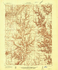
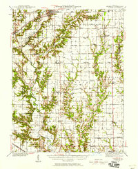
1936 Map of Casey
USGS Topo · Published 1936About this map
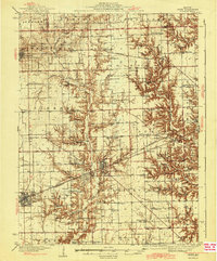
The Pennsylvania Railroad corridor forms a primary east-west spine through this Clark County landscape, connecting Casey and Martinsville during a period of steady agrarian and industrial activity. The presence of an active Tank Farm near Martinsville and the settlement of Oilfield to the west points toward the region's historical ties to petroleum production. This industrial footprint is balanced by a dense network of rural infrastructure, where small schools like Jeff Davis Sch and Spikertown Sch are spaced alongside community landmarks such as Pikes Peak Ch.
Find a feature on this map
60 named features on this map. Tap any name to fly to it.
Don’t see what you’re looking for? This feature index may not catch every label — zoom into the map to look around manually.
Map Details
Editions of this 1936 Casey Map
This is the sole edition of this map. No revisions or reprints were ever made.
Other maps of this area
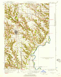
1932 · Marshall
USGS Topo · 1:62,500

1933 · Toledo
USGS Topo · 1:62,500
1936 · Oakland
USGS Topo · 1:48,000
1937 · Marshall
USGS Topo · 1:62,500

1938 · Toledo
USGS Topo · 1:62,500
1940 · Greenup
USGS Topo · 1:62,500
1942 · Oakland
USGS Topo · 1:62,500
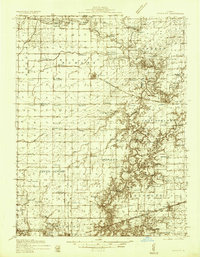
1942 · Casey
USGS Topo · 1:62,500
1943 · Greenup
USGS Topo · 1:62,500
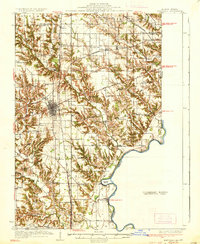
1943 · Casey
USGS Topo · 1:62,500