2024 Map of Cash
USGS Topo · Published 2024About this map
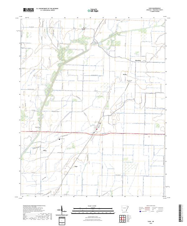
The Cache River and its intricate network of drainage canals, including Ditch Number 32 and Angle Ditch Lateral Number 4, define the agricultural landscape of western Craighead County. This modern survey illustrates how water management has shaped the region, with the river meandering through a complex of low-lying wetlands and sloughs. Small rural settlements like Cash and Fisher are connected by a grid of county roads that crisscross the fertile bottomlands, while the community of Egypt sits at the northern edge of this drainage system.
Find a feature on this map
65 named features on this map. Tap any name to fly to it.
Don’t see what you’re looking for? This feature index may not catch every label — zoom into the map to look around manually.
Map Details
Editions of this 2024 Cash Map
This is the sole edition of this map. No revisions or reprints were ever made.