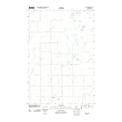
2010 Map of Casino
USGS Topo · Published 2010About this map
The small settlement of Bridgeman anchors the southern portion of this northern Minnesota landscape, where the Bridgeman Cemetery provides a primary point of interest for genealogists and local historians. This region is characterized by a dense network of water bodies and marshy lowlands, including the distinctive Ghost Hill and Pine Island. The map reveals a transition from the structured grid of rural roads like 116th St SW to the more organic drainage patterns of Mosquito Creek and Sevenmile Creek. To the north, a cluster of named lakes such as Ackerson Lake, Round Lake, and Hogans Lake highlights the post-glacial topography of the area. The presence of Casino along 104th St SW further illustrates the scattered nature of rural communities in this part of Cass County during the early 21st century.
Find a feature on this map
41 named features on this map. Tap any name to fly to it.
Don’t see what you’re looking for? This feature index may not catch every label — zoom into the map to look around manually.
Map Details
Editions of this 2010 Casino Map
This is the sole edition of this map. No revisions or reprints were ever made.
Other maps of this area

1916 · Pillager
USGS Topo · 1:62,500

1919 · Pillager
USGS Topo · 1:62,500

1919 · Leader
USGS Topo · 1:62,500

1953 · Brainerd
USGS Topo · 1:250,000

1954 · Pillager
USGS Topo · 1:24,000

1957 · Brainerd
USGS Topo · 1:250,000

1958 · Brainerd
USGS Topo · 1:250,000

1959 · Pine River SW
USGS Topo · 1:24,000
1963 · Motley SE
USGS Topo · 1:24,000

1963 · Motley
USGS Topo · 1:24,000