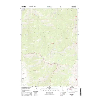
2017 Map of Casino Lakes
USGS Topo · Published 2017About this map
Challis National Forest and Sawtooth National Forest converge in this high-altitude landscape of the central Idaho wilderness. The map is defined by its complex drainage systems, where the Salmon River flows across the northern edge, fed by an intricate network of waterways including Big Casino Cr and Little Casino Cr. The namesake Casino Lakes are positioned at the heart of this terrain, surrounded by other alpine features such as Rough Lake and the Garland Lakes.
Find a feature on this map
27 named features on this map. Tap any name to fly to it.
Don’t see what you’re looking for? This feature index may not catch every label — zoom into the map to look around manually.
Map Details
Editions of this 2017 Casino Lakes Map
This is the sole edition of this map. No revisions or reprints were ever made.
Other maps of this area

1919 · Custer
USGS Topo · 1:125,000

1922 · Custer
USGS Topo · 1:125,000

1957 · Challis
USGS Topo · 1:250,000

1960 · Challis
USGS Topo · 1:250,000

1963 · Challis
USGS Topo · 1:250,000

1963 · Mt Cramer
USGS Topo · 1:24,000

1963 · Stanley
USGS Topo · 1:24,000

1963 · Basin Butte
USGS Topo · 1:24,000

1963 · Casino Lakes
USGS Topo · 1:24,000
1963 · Obsidian
USGS Topo · 1:24,000