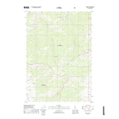
2020 Map of Casino Lakes
USGS Topo · Published 2020About this map
The Sawtooth Valley floor meets the rising peaks of the high backcountry in this detailed survey of Custer County. Spanning the boundary between the Challis National Forest and the Sawtooth National Forest, the landscape is defined by an intricate network of alpine drainage systems, including Little Casino Cr, Big Casino Cr, and Cleveland Cr. The namesake Casino Lakes and nearby Rough Lake sit at the headwaters of these drainages, surrounded by prominent landmarks like Lookout Mtn and Prospect Point.
Find a feature on this map
54 named features on this map. Tap any name to fly to it.
Don’t see what you’re looking for? This feature index may not catch every label — zoom into the map to look around manually.
Map Details
Editions of this 2020 Casino Lakes Map
This is the sole edition of this map. No revisions or reprints were ever made.
Other maps of this area

1919 · Custer
USGS Topo · 1:125,000

1922 · Custer
USGS Topo · 1:125,000

1957 · Challis
USGS Topo · 1:250,000

1960 · Challis
USGS Topo · 1:250,000

1963 · Challis
USGS Topo · 1:250,000

1963 · Mt Cramer
USGS Topo · 1:24,000

1963 · Stanley
USGS Topo · 1:24,000

1963 · Basin Butte
USGS Topo · 1:24,000

1963 · Casino Lakes
USGS Topo · 1:24,000
1963 · Obsidian
USGS Topo · 1:24,000