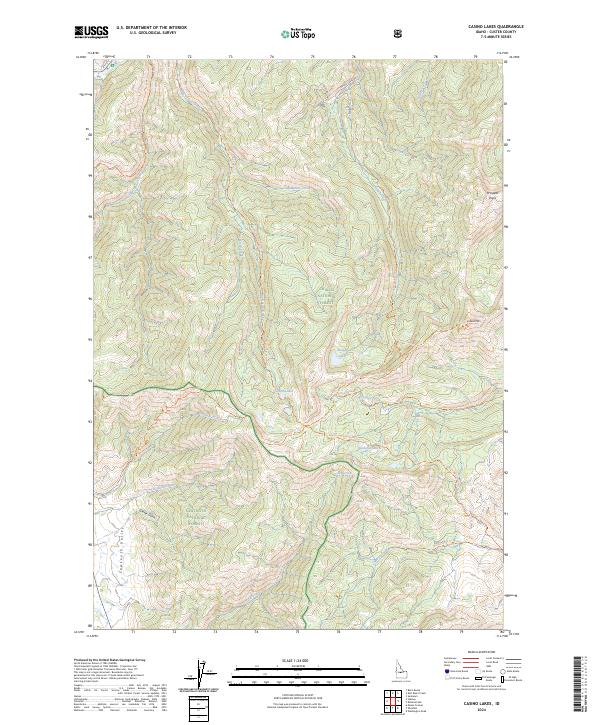
2024 Map of Casino Lakes
USGS Topo · Published 2024About this map
Casino Lakes and the alpine basins of the Salmon River Mountains define this high-elevation Idaho landscape. Positioned at the intersection of three major federal land designations, the map illustrates the complex forest management of the Challis National Forest, White Clouds Wilderness, and Sawtooth National Forest. A dense network of pack trails, including the Martin-Big Casino Trail and the Rough Creek Skyline Trail, snakes through the drainages of Big Casino Creek and Rough Creek, tracing the historical access routes to high-country water bodies like Garland Lakes and Rough Lake. The western edge of the quadrangle descends into the Sawtooth Valley near Grover Gulch, while the eastern peaks culminate at landmarks such as Lookout Mountain and Prospect Point.
Find a feature on this map
36 named features on this map. Tap any name to fly to it.
Don’t see what you’re looking for? This feature index may not catch every label — zoom into the map to look around manually.
Map Details
Editions of this 2024 Casino Lakes Map
This is the sole edition of this map. No revisions or reprints were ever made.
Other maps of this area

1919 · Custer
USGS Topo · 1:125,000

1922 · Custer
USGS Topo · 1:125,000

1957 · Challis
USGS Topo · 1:250,000

1960 · Challis
USGS Topo · 1:250,000

1963 · Challis
USGS Topo · 1:250,000

1963 · Mt Cramer
USGS Topo · 1:24,000

1963 · Stanley
USGS Topo · 1:24,000

1963 · Basin Butte
USGS Topo · 1:24,000

1963 · Casino Lakes
USGS Topo · 1:24,000
1963 · Obsidian
USGS Topo · 1:24,000