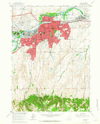
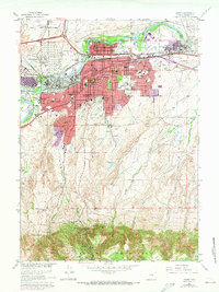
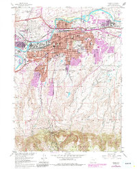
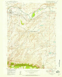
1961 Map of Casper
USGS Topo · Published 1965About this map
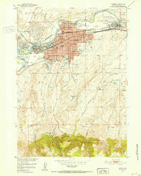
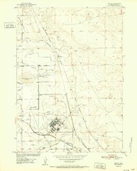
The North Platte River winds across the northern reaches of this mid-century survey, anchoring a landscape where industrial energy production meets established residential growth. The core of Casper is shown in detail, including the City and Co Bldg and numerous neighborhood institutions like St Anthony Sch and Highland Cemetery. To the west, the Fort Caspar Historic Grounds preserve a connection to the earlier frontier era near the banks of Casper Creek.
Find a feature on this map
58 named features on this map. Tap any name to fly to it.
Don’t see what you’re looking for? This feature index may not catch every label — zoom into the map to look around manually.
Map Details
Editions of this 1961 Casper Map
3 editions found
Other maps of this area
1949 · Brookhurst
USGS Topo · 1:24,000
1949 · Pratts Soda Lakes
USGS Topo · 1:24,000
1950 · Brookhurst
USGS Topo · 1:24,000

1950 · Pratts Soda Lakes
USGS Topo · 1:24,000

1950 · Goose Egg
USGS Topo · 1:24,000

1951 · The Reefs
USGS Topo · 1:24,000
1951 · Casper
USGS Topo · 1:24,000
1952 · Bishop
USGS Topo · 1:24,000

1955 · Casper
USGS Topo · 1:250,000

1958 · Casper
USGS Topo · 1:250,000