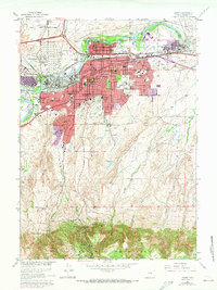
1961 Map of Casper
USGS Topo · Published 1973About this map
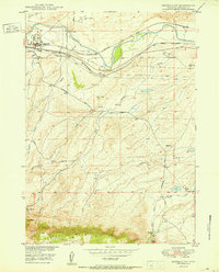
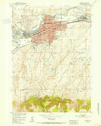
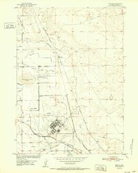
Casper serves as the industrial and civic hub of Natrona County in this early 1960s study, revised through the early 1970s. The urban landscape is defined by its relationship with the North Platte River, where an extensive Oil Tank Farm and numerous gravel pits underscore the region's energy and resource foundation. Beyond the commercial core, the map detail captures the educational and social infrastructure of the era, from the University of Wyoming Casper College to specialized facilities like the State Childrens Home and Home for the Aged.
Find a feature on this map
62 named features on this map. Tap any name to fly to it.
Don’t see what you’re looking for? This feature index may not catch every label — zoom into the map to look around manually.
Map Details
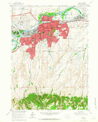
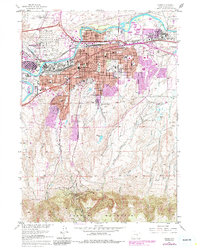
Editions of this 1961 Casper Map
3 editions found
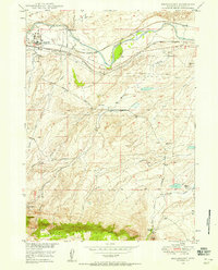
Other maps of this area
1949 · Brookhurst
USGS Topo · 1:24,000
1949 · Pratts Soda Lakes
USGS Topo · 1:24,000
1950 · Brookhurst
USGS Topo · 1:24,000

1950 · Pratts Soda Lakes
USGS Topo · 1:24,000

1950 · Goose Egg
USGS Topo · 1:24,000

1951 · The Reefs
USGS Topo · 1:24,000
1951 · Casper
USGS Topo · 1:24,000
1952 · Bishop
USGS Topo · 1:24,000

1955 · Casper
USGS Topo · 1:250,000

1958 · Casper
USGS Topo · 1:250,000