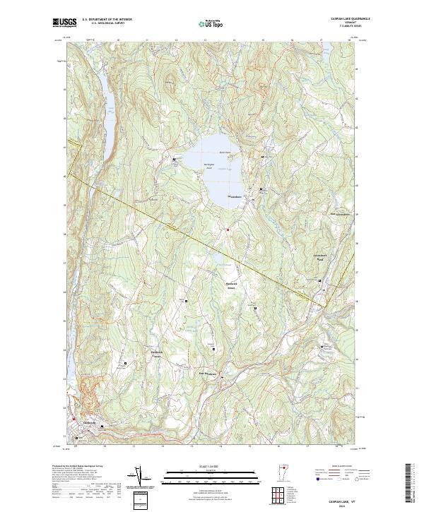
2024 Map of Caspian Lake
USGS Topo · Published 2024About this map
Caspian Lake serves as a central geographic anchor for this part of Vermont, surrounded by a network of small upland settlements and agricultural hills. The village of Greensboro sits on the southern shore, while the surrounding landscape is defined by high points like Barr Hill and Mt Sarah. The regional movement of goods and people is traced through the Lamoille Valley Rail Trl, which follows the curve of the Lamoille River through Hardwick and toward Greensboro Bend.
Find a feature on this map
102 named features on this map. Tap any name to fly to it.
Don’t see what you’re looking for? This feature index may not catch every label — zoom into the map to look around manually.
Map Details
Editions of this 2024 Caspian Lake Map
This is the sole edition of this map. No revisions or reprints were ever made.
Other maps of this area

1928 · Hardwick
USGS Topo · 1:62,500

1934 · Hardwick
USGS Topo · 1:48,000

1935 · Lyndonville
USGS Topo · 1:48,000

1938 · Hardwick
USGS Topo · 1:62,500

1938 · St. Johnsbury
USGS Topo · 1:48,000

1939 · Lyndonville
USGS Topo · 1:62,500

1939 · Plainfield
USGS Topo · 1:48,000

1940 · Plainfield
USGS Topo · 1:62,500

1943 · Plainfield
USGS Topo · 1:62,500

1943 · St. Johnsbury
USGS Topo · 1:62,500