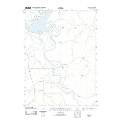
2012 Map of Cassa
USGS Topo · Published 2012About this map
Cassa and the surrounding Platte County landscape are defined by the winding course of the N Platte River as it flows into the southern reaches of the Glendo Reservoir. This 2012 survey illustrates a region where water management and recreation dominate the geography, notably within the boundaries of Glendo State Park. Small-scale irrigation and ranching remain evident through features like the Hooley Reservoir and Twiford Reservoir, alongside named holdings such as the Haushar Ranch. The terrain is deeply incised by numerous draws and canyons, including Stroda Draw, Ragan Draw, and the prominent Sawmill Canyon to the southeast. Landmarks like Baldy Mountain and Stroda Point provide significant relief above the river valley, while the residential street grid near the reservoir shore contrasts with the open rangeland and intricate drainage patterns of the N Bear Cr and Middle Bear Cr.
Find a feature on this map
37 named features on this map. Tap any name to fly to it.
Don’t see what you’re looking for? This feature index may not catch every label — zoom into the map to look around manually.
Map Details
Editions of this 2012 Cassa Map
This is the sole edition of this map. No revisions or reprints were ever made.
Other maps of this area

1896 · Hartville
USGS Topo · 1:125,000

1901 · Hartville
USGS Topo · 1:125,000

1949 · Cedar Top
USGS Topo · 1:24,000

1950 · Glendo
USGS Topo · 1:24,000

1950 · Cedar Top
USGS Topo · 1:24,000

1950 · Jewel Springs
USGS Topo · 1:24,000

1950 · Coleman Butte
USGS Topo · 1:24,000

1950 · Herman Ranch
USGS Topo · 1:24,000

1950 · Haushar Ranch
USGS Topo · 1:24,000

1950 · Guernsey Reservoir
USGS Topo · 1:24,000