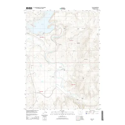
2015 Map of Cassa
USGS Topo · Published 2015About this map
The North Platte River winds through this Platte County landscape, shaping the geography of central Wyoming just downstream from the Glendo Reservoir. The small settlement of Cassa sits in the valley where the river begins to carve deeper into the high plains, flanked by numerous drainages such as Stroda Draw and Ragan Draw. This 2015 survey reveals a terrain defined by its water resources, from the larger reservoir in the northwest to smaller ranching landmarks like Hooley Reservoir and Twiford Reservoir. Significant topographic features rise above the riverbed, including Baldy Mtn and the narrow passage of Wendover Canyon to the southeast. Local access is traced through a network of rural routes including Cassa Rd and State Parks Rd, reflecting the area's mix of agricultural use and recreational proximity. The map also documents several natural springs and seasonal creeks, such as Twin Springs and Horseshoe Cr, which contribute to the drainage basin of the North Platte.
Find a feature on this map
42 named features on this map. Tap any name to fly to it.
Don’t see what you’re looking for? This feature index may not catch every label — zoom into the map to look around manually.
Map Details
Editions of this 2015 Cassa Map
This is the sole edition of this map. No revisions or reprints were ever made.
Other maps of this area

1896 · Hartville
USGS Topo · 1:125,000

1901 · Hartville
USGS Topo · 1:125,000

1949 · Cedar Top
USGS Topo · 1:24,000

1950 · Glendo
USGS Topo · 1:24,000

1950 · Cedar Top
USGS Topo · 1:24,000

1950 · Jewel Springs
USGS Topo · 1:24,000

1950 · Coleman Butte
USGS Topo · 1:24,000

1950 · Herman Ranch
USGS Topo · 1:24,000

1950 · Haushar Ranch
USGS Topo · 1:24,000

1950 · Guernsey Reservoir
USGS Topo · 1:24,000