2017 Map of Cassa
USGS Topo · Published 2017About this map
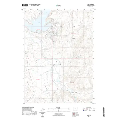
Cassa sits at a strategic point along the North Platte River, serving as a central node in a landscape defined by water management and high plains drainage. The construction of the Glendo Reservoir has fundamentally reshaped the northern portion of this area, creating a shoreline marked by features like Sunset Point and a network of recreational paths including the Wetland Trail and Narrows Bluff Trail. Away from the main reservoir, the land is etched by numerous draws and canyons, such as Wendover Canyon and Sawmill Canyon, which channel seasonal runoff from prominent heights like Baldy Mtn. The presence of smaller impoundments like Hooley Reservoir and Twiford Reservoir suggests a continued reliance on local water storage for ranching or irrigation in this arid Wyoming environment, while Bulls Bend marks a significant meander in the river's course through the Platte County terrain.
Find a feature on this map
56 named features on this map. Tap any name to fly to it.
Don’t see what you’re looking for? This feature index may not catch every label — zoom into the map to look around manually.
Map Details
Editions of this 2017 Cassa Map
This is the sole edition of this map. No revisions or reprints were ever made.
Other maps of this area

1896 · Hartville
USGS Topo · 1:125,000

1901 · Hartville
USGS Topo · 1:125,000

1949 · Cedar Top
USGS Topo · 1:24,000

1950 · Glendo
USGS Topo · 1:24,000

1950 · Cedar Top
USGS Topo · 1:24,000

1950 · Jewel Springs
USGS Topo · 1:24,000

1950 · Coleman Butte
USGS Topo · 1:24,000

1950 · Herman Ranch
USGS Topo · 1:24,000

1950 · Haushar Ranch
USGS Topo · 1:24,000

1950 · Guernsey Reservoir
USGS Topo · 1:24,000