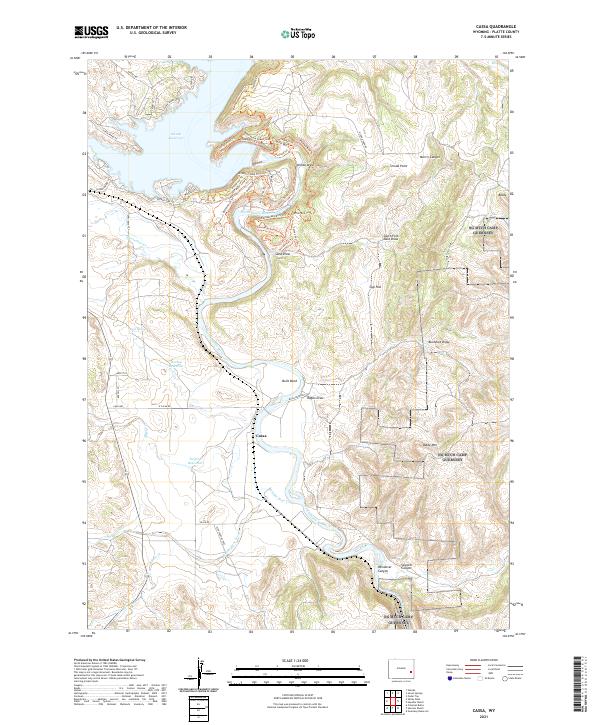
2021 Map of Cassa
USGS Topo · Published 2021About this map
The North Platte River carves a winding path through the center of this Wyoming landscape, supporting a complex network of water management and recreation. The northern edge of the sheet is dominated by the expansive Glendo Reservoir, where numerous modern trails like Narrow Bluff Trl and Sunset Point Trl trace the shoreline and surrounding ridges. In the flatter lands to the south, the small settlement of Cassa sits near the river's edge, surrounded by localized reservoirs including Twiford Reservoir and Hooley Reservoir. The terrain is characterized by a series of deep draws and canyons, such as Wendover Canyon and Sawmill Canyon, which reveal the erosive power of the river system. Higher elevations are marked by landmarks like Baldy Mtn and Stroda Point, while the presence of Gyp Flat and Buckshot Draw suggests the varied geological character of this Platte County region.
Find a feature on this map
65 named features on this map. Tap any name to fly to it.
Don’t see what you’re looking for? This feature index may not catch every label — zoom into the map to look around manually.
Map Details
Editions of this 2021 Cassa Map
This is the sole edition of this map. No revisions or reprints were ever made.
Other maps of this area

1896 · Hartville
USGS Topo · 1:125,000

1901 · Hartville
USGS Topo · 1:125,000

1949 · Cedar Top
USGS Topo · 1:24,000

1950 · Glendo
USGS Topo · 1:24,000

1950 · Cedar Top
USGS Topo · 1:24,000

1950 · Jewel Springs
USGS Topo · 1:24,000

1950 · Coleman Butte
USGS Topo · 1:24,000

1950 · Herman Ranch
USGS Topo · 1:24,000

1950 · Haushar Ranch
USGS Topo · 1:24,000

1950 · Guernsey Reservoir
USGS Topo · 1:24,000