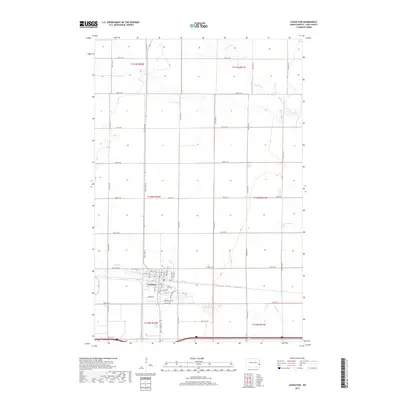
2017 Map of Casselton
USGS Topo · Published 2017About this map
Casselton serves as the primary hub in this portion of Cass County, defined by a rigid grid of agricultural section lines and localized residential expansion. The landscape is marked by the slow meanders of Rush River in the north and Swan Cr to the south, watercourses that break the otherwise rectilinear pattern of rural roads like Old Co Rd 10 and Co Rd 20. Within the town, the street names reflect a mix of traditional planning and modern development, ranging from the historic Front St near the central rail corridor to newer residential areas along Willow Bend Dr and Fairway Dr. The Saint Leo Cem stands on the eastern edge of the settlement, providing a specific point of interest for genealogists tracing family roots in this Red River Valley community.
Find a feature on this map
37 named features on this map. Tap any name to fly to it.
Don’t see what you’re looking for? This feature index may not catch every label — zoom into the map to look around manually.
Map Details
Editions of this 2017 Casselton Map
This is the sole edition of this map. No revisions or reprints were ever made.
Other maps of this area

1895 · Casselton
USGS Topo · 1:125,000

1897 · Casselton
USGS Topo · 1:125,000

1952 · Grand Forks
USGS Topo · 1:250,000

1953 · Fargo
USGS Topo · 1:250,000

1956 · Fargo
USGS Topo · 1:250,000

1956 · Grand Forks
USGS Topo · 1:250,000

1961 · Durbin
USGS Topo · 1:24,000

1961 · Casselton
USGS Topo · 1:24,000
1961 · Casselton SE
USGS Topo · 1:24,000
1961 · Mapleton
USGS Topo · 1:24,000