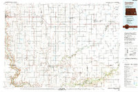
1986 Map of Casselton
USGS Topo · Published 1988About this map
Burlington Northern rail corridors dominate the landscape of the Red River Valley in the mid-1980s, connecting numerous grain-elevator towns like Buffalo, Wheatland, and Amenia. This region is defined by a dense grid of townships, including Tower, Howes, and Everest, where the transition from the flat glacial lake plain to the more varied terrain of the Eastedge begins. Along the western border, Valley City sits near the winding course of the Sheyenne River, which flows southward toward the Sheyenne National Grassland and Ft Ransom State Park.
Find a feature on this map
119 named features on this map. Tap any name to fly to it.
Don’t see what you’re looking for? This feature index may not catch every label — zoom into the map to look around manually.
Map Details
Editions of this 1986 Casselton Map
2 editions found
Other maps of this area

1895 · Lamoure
USGS Topo · 1:125,000

1895 · Fargo
USGS Topo · 1:125,000

1895 · Casselton
USGS Topo · 1:125,000

1897 · Fargo
USGS Topo · 1:125,000

1897 · Tower
USGS Topo · 1:125,000

1897 · Eckelson
USGS Topo · 1:125,000

1897 · Casselton
USGS Topo · 1:125,000

1904 · Wahpeton
USGS Topo · 1:125,000

1907 · Wyndmere
USGS Topo · 1:125,000

1918 · La Moure
USGS Topo · 1:125,000