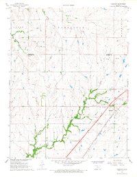
1967 Map of Cassoday
USGS Topo · Published 1968About this map
Cassoday serves as the focal point of this late 1960s landscape, situated at the crossroads of modern infrastructure and traditional agricultural terrain. The town is flanked by the Atchison Topeka and Santa Fe railroad and the Kansas Toll Road Turnpike, which features the prominent Cassoday Interchange. This juxtaposition highlight's the area's transition from a rail-dependent livestock hub to an era dominated by high-speed interstate travel. The Walnut River and its tributaries, including School Branch and Middle Creek, carve through the surrounding townships of Sycamore, Cedar, and Homestead. Local landmarks like the Cassoday Cem and a nearby Quarry offer specific points of interest for genealogists and local historians, while a network of industrial pipelines and a Pumping Station indicate the ongoing utility development across the Butler and Chase county line.
Find a feature on this map
19 named features on this map. Tap any name to fly to it.
Don’t see what you’re looking for? This feature index may not catch every label — zoom into the map to look around manually.
Map Details
Editions of this 1967 Cassoday Map
3 editions found
Other maps of this area

1888 · Eldorado
USGS Topo · 1:125,000

1898 · Cottonwood Falls
USGS Topo · 1:125,000

1955 · Wichita
USGS Topo · 1:250,000

1955 · Hutchinson
USGS Topo · 1:250,000

1957 · Wonsevu
USGS Topo · 1:24,000

1958 · Wichita
USGS Topo · 1:250,000

1959 · Hutchinson
USGS Topo · 1:250,000

1961 · De Graff
USGS Topo · 1:24,000

1961 · Rosalia NE
USGS Topo · 1:24,000
1961 · Rosalia NW
USGS Topo · 1:24,000