1967 Map of Cassoday
USGS Topo · Published 1991About this map
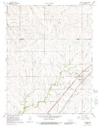
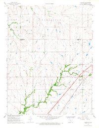
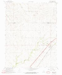
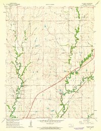
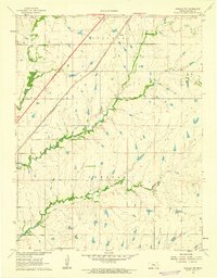
Cassoday serves as the focal point for this landscape in the late 1960s, positioned where modern infrastructure meets the natural drainage of the Walnut River. The map illustrates a era of transition for Butler County, as the Kansas Toll Road and the Cassoday Interchange cut diagonally across the terrain, running parallel to the historic tracks of the Atchison Topeka and Santa Fe railroad. These transit corridors dominate the eastern half of the survey, contrasting with the more rural reaches of Sycamore and Homestead. Local researchers can locate the Cassoday Cem north of the village and trace several watercourses, including Middle Creek and School Branch, which defined the early boundaries of the townships and land claims in this part of Kansas. Several industrial markers, such as a Pumping Station and multiple pipelines, suggest the continued importance of regional utilities during this period.
Find a feature on this map
18 named features on this map. Tap any name to fly to it.
Don’t see what you’re looking for? This feature index may not catch every label — zoom into the map to look around manually.
Map Details
Editions of this 1967 Cassoday Map
3 editions found
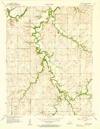
Other maps of this area

1888 · Eldorado
USGS Topo · 1:125,000

1898 · Cottonwood Falls
USGS Topo · 1:125,000

1955 · Wichita
USGS Topo · 1:250,000

1955 · Hutchinson
USGS Topo · 1:250,000
1957 · Wonsevu
USGS Topo · 1:24,000

1958 · Wichita
USGS Topo · 1:250,000

1959 · Hutchinson
USGS Topo · 1:250,000
1961 · De Graff
USGS Topo · 1:24,000

1961 · Rosalia NE
USGS Topo · 1:24,000
1961 · Rosalia NW
USGS Topo · 1:24,000