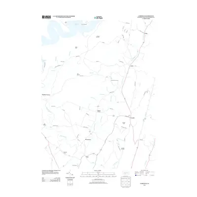
2013 Map of Cassville
USGS Topo · Published 2013About this map
Paradise Furnace stands as a point of industrial history in this region of Huntingdon County, where narrow valleys dictate the flow of both water and commerce. The map documents a landscape defined by the winding course of Great Trough Creek, which links settlements such as Todd, Beavertown, and Cassville. The terrain is dominated by prominent elevations like Terrace Mountain and Shirley Knob, while The Barrens indicates areas of distinct vegetation or soil composition. Small-scale aviation is represented by Lincoln Farms Airport and Schrenkel Airport, serving these relatively isolated communities. The presence of Eagle Foundary near the southern edge further underscores the area's legacy of ironworking and manufacturing. For those researching local lineages, the map provides precise locations for family-named land features and the scattered hamlets of Cherry Grove, Calvin, and Colfax.
Find a feature on this map
88 named features on this map. Tap any name to fly to it.
Don’t see what you’re looking for? This feature index may not catch every label — zoom into the map to look around manually.
Map Details
Editions of this 2013 Cassville Map
This is the sole edition of this map. No revisions or reprints were ever made.
Other maps of this area

1901 · Huntingdon
USGS Topo · 1:62,500

1904 · Huntingdon
USGS Topo · 1:62,500

1922 · Mt Union
USGS Topo · 1:48,000

1924 · Mt. Union
USGS Topo · 1:62,500

1930 · Broad Top
USGS Topo · 1:62,500

1933 · Broad Top
USGS Topo · 1:62,500

1939 · Orbisonia
USGS Topo · 1:62,500

1940 · Orbisonia
USGS Topo · 1:62,500

1944 · Orbisonia
USGS Topo · 1:62,500

1944 · Mt. Union
USGS Topo · 1:62,500