
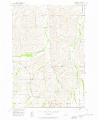
1956 Map of Castagne
USGS Topo · Published 1958About this map
The high plains of Carbon County meet a complex network of irrigation at the settlement of Castagne. This mid-century survey reveals a landscape transformed by water management, where numerous man-made channels like the Caldwell Ditch, Pleasant Valley Ditch, and Harney Ditch divert flow from the branching forks of Red Lodge Creek. These ditches follow the contours of the terrain to support agriculture between the valley floors and the higher elevations of the Missouri Cutoff. Local history is anchored by rural community landmarks, including the Hogan Sch near the confluence of Hogan Creek and the John Henry Cem located further south. The topography is defined by significant drainage systems such as Willow Creek and Schroeder Gulch, which carve through the foothills at the edge of the Missouri River Basin development area.
Find a feature on this map
36 named features on this map. Tap any name to fly to it.
Don’t see what you’re looking for? This feature index may not catch every label — zoom into the map to look around manually.
Map Details
Editions of this 1956 Castagne Map
2 editions found
Other maps of this area

1932 · Red Lodge No 2
USGS Topo · 1:48,000

1932 · Red Lodge No 1
USGS Topo · 1:48,000

1944 · Red Lodge
USGS Topo · 1:62,500

1954 · Billings
USGS Topo · 1:250,000

1956 · Roscoe
USGS Topo · 1:24,000

1956 · Roscoe NW
USGS Topo · 1:24,000

1956 · Roscoe NE
USGS Topo · 1:24,000

1956 · Roberts
USGS Topo · 1:24,000

1956 · Mount Maurice
USGS Topo · 1:62,500
1956 · Cooney Reservoir
USGS Topo · 1:24,000