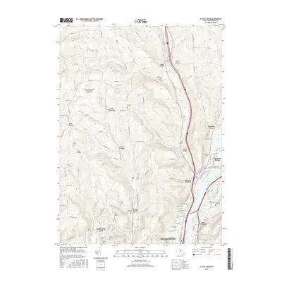
2016 Map of Castle Creek
USGS Topo · Published 2016About this map
The hills north of Binghamton and Johnson City are defined by the winding course of the Chenango River and its varied tributaries. This 2016 survey illustrates the developed corridor between Port Dickinson and Chenango Bridge, while tracing the rural uplands toward Castle Creek and East Maine. Significant institutional footprints are visible, including the Broome Community College campus and the Greater Binghamton Airport. Genealogy researchers will find numerous burial sites throughout the landscape, from the Maple Grove Cemetery in the north to the Calvary Cemetery further south. The map documents the persistent identity of local hamlets like New Ireland and Choconut Center, alongside major recreation areas such as Otsiningo Park along the riverbank. This edition serves as a record of the modern suburban and industrial growth that has filled the valleys once dominated by creek-side agriculture.
Find a feature on this map
139 named features on this map. Tap any name to fly to it.
Don’t see what you’re looking for? This feature index may not catch every label — zoom into the map to look around manually.
Map Details
Editions of this 2016 Castle Creek Map
This is the sole edition of this map. No revisions or reprints were ever made.
Other maps of this area

1901 · Apalachin
USGS Topo · 1:62,500

1903 · Harford
USGS Topo · 1:62,500

1904 · Binghamton
USGS Topo · 1:62,500

1904 · Greene
USGS Topo · 1:62,500

1904 · Apalachin
USGS Topo · 1:62,500

1906 · Catatonk
USGS Topo · 1:125,000

1934 · Castle Creek
USGS Topo · 1:24,000

1935 · Binghamton West
USGS Topo · 1:24,000

1935 · Chenango Forks
USGS Topo · 1:24,000

1937 · Binghamton East
USGS Topo · 1:24,000