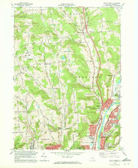
1968 Map of Castle Creek
USGS Topo · Published 1972About this map
Broome County Airport and the expanding northern suburbs of Johnson City define this late-1960s landscape in Broome County. The map documents a period of significant infrastructure development, most notably the complex highway network represented by Interchange 4 through Interchange 8 along the eastern corridor. The Chenango River serves as a primary geographic anchor, flanked by the Erie Lackawanna and Delaware and Hudson railroads, illustrating the area's role as a transportation hub.
Find a feature on this map
65 named features on this map. Tap any name to fly to it.
Don’t see what you’re looking for? This feature index may not catch every label — zoom into the map to look around manually.
Map Details
Editions of this 1968 Castle Creek Map
2 editions found
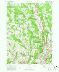
Other maps of this area

1901 · Apalachin
USGS Topo · 1:62,500

1903 · Harford
USGS Topo · 1:62,500

1904 · Binghamton
USGS Topo · 1:62,500

1904 · Greene
USGS Topo · 1:62,500

1904 · Apalachin
USGS Topo · 1:62,500

1906 · Catatonk
USGS Topo · 1:125,000

1934 · Castle Creek
USGS Topo · 1:24,000

1935 · Binghamton West
USGS Topo · 1:24,000

1935 · Chenango Forks
USGS Topo · 1:24,000

1937 · Binghamton East
USGS Topo · 1:24,000