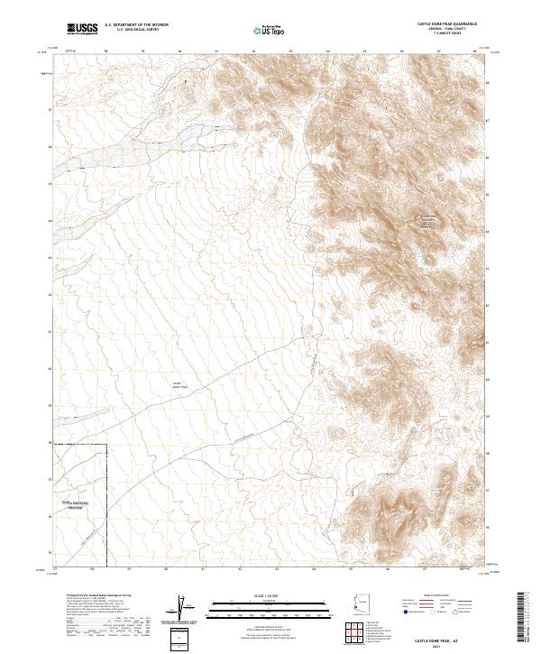
2021 Map of Castle Dome Peak
USGS Topo · Published 2021About this map
Castle Dome Peak anchors this southwestern Arizona landscape, serving as a prominent landmark within the Castle Dome Mountains. The terrain transitions from the high peaks of the range down into the Castle Dome Plain, a wide expanse defined by drainage patterns like Gravel Wash. This area of Yuma County is characterized by its isolation and the presence of critical water sources in an arid environment, such as Doc Carter Spring. The most significant human imprint on the land is the Castle Dome Mine Rd, which cuts across the plain and into the foothills. This road likely served the historical mining districts located just beyond the immediate peaks, reflecting the long-standing mineral exploitation that defined the region's early development and infrastructure.
Find a feature on this map
12 named features on this map. Tap any name to fly to it.
Don’t see what you’re looking for? This feature index may not catch every label — zoom into the map to look around manually.
Map Details
Editions of this 2021 Castle Dome Peak Map
This is the sole edition of this map. No revisions or reprints were ever made.
Other maps of this area

1929 · Laguna
USGS Topo · 1:62,500

1939 · Red Hill
USGS Topo · 1:62,500

1942 · Yuma
USGS Topo · 1:250,000

1942 · Blythe
USGS Topo · 1:250,000

1943 · Laguna
USGS Topo · 1:62,500

1954 · El Centro
USGS Topo · 1:250,000

1954 · Salton Sea
USGS Topo · 1:250,000

1954 · Red Hill
USGS Topo · 1:62,500

1955 · Salton Sea
USGS Topo · 1:250,000

1955 · El Centro
USGS Topo · 1:250,000