
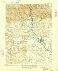
1916 Map of Castle Gate
USGS Topo · Published 1938About this map
Industrial expansion in the Carbon County coalfields defines this 1914 survey, which highlights the complex relationship between narrow canyon settlements and the vital rail corridors of the Price River. The map documents the early 20th-century coal economy through mining hubs like Standardville, Storrs, and Kenilworth, alongside the heavy industrial footprint of the Aberdeen Mine and Milburn Mine. The dramatic topography of the Book Cliffs and Castle Gate dictates the layout of the Denver and Rio Grande Railway and the Utah Railway, which snake through the steep terrain to reach these remote extraction sites.
Find a feature on this map
59 named features on this map. Tap any name to fly to it.
Don’t see what you’re looking for? This feature index may not catch every label — zoom into the map to look around manually.
Map Details
Editions of this 1916 Castle Gate Map
2 editions found
Other maps of this area

1885 · Manti
USGS Topo · 1:250,000

1886 · Price River
USGS Topo · 1:250,000

1895 · Manti
USGS Topo · 1:250,000

1896 · Price River
USGS Topo · 1:250,000

1914 · Castle Gate
USGS Topo · 1:62,500

1915 · Wellington
USGS Topo · 1:62,500

1923 · Scofield
USGS Topo · 1:62,500

1923 · Hiawatha
USGS Topo · 1:62,500

1925 · Scofield
USGS Topo · 1:62,500

1925 · Hiawatha
USGS Topo · 1:62,500