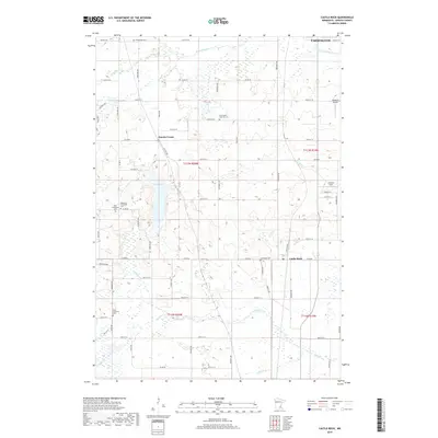
2019 Map of Castle Rock
USGS Topo · Published 2019About this map
Eureka Center and the village of Castle Rock define this portion of Dakota County, where a heavy concentration of burial grounds reflects the deep Lutheran heritage of the region's early settlers. The landscape is dotted with sites like Farmington Lutheran Cem, East Christiania Cem, and Highview Christiana Cem, many of which are associated with the small communities and rural intersections of the early 21st century.
Find a feature on this map
69 named features on this map. Tap any name to fly to it.
Don’t see what you’re looking for? This feature index may not catch every label — zoom into the map to look around manually.
Map Details
Editions of this 2019 Castle Rock Map
This is the sole edition of this map. No revisions or reprints were ever made.
Other maps of this area

1953 · Saint Paul
USGS Topo · 1:250,000

1957 · Farmington
USGS Topo · 1:62,500

1957 · Prior Lake
USGS Topo · 1:62,500

1959 · Saint Paul
USGS Topo · 1:250,000

1960 · Northfield
USGS Topo · 1:24,000

1960 · Dennison
USGS Topo · 1:24,000

1960 · Little Chicago
USGS Topo · 1:24,000
1974 · Coates
USGS Topo · 1:24,000
1974 · New Market
USGS Topo · 1:24,000
1974 · Randolph
USGS Topo · 1:24,000