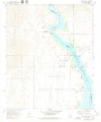
1970 Map of Castle Rock
USGS Topo · Published 1979About this map
The Chemehuevi Indian Reservation dominates the western shore of the Colorado River in this survey of the desert borderlands between California and Arizona. Following the completion of Parker Dam decades prior, the river widens into Lake Havasu, filling the Chemehuevi Valley and creating numerous inlets such as Clear Bay and Jops Harbor. The landscape is a stark contrast between the steep, jagged Chemehuevi Mts to the west and the riparian environment of the Havasu National Wildlife Refuge along the water. Significant cultural sites are marked along the northern edge, including the Picture Rock Petroglyphs near the entrance to Mohave Canyon. This era shows the beginnings of recreational development on the Arizona side near Castle Rock, while the California shore remains largely focused on the reservation and the Chemehuevi Landing Field.
Find a feature on this map
38 named features on this map. Tap any name to fly to it.
Don’t see what you’re looking for? This feature index may not catch every label — zoom into the map to look around manually.
Map Details
Editions of this 1970 Castle Rock Map
2 editions found
Other maps of this area

1903 · Needles
USGS Topo · 1:125,000

1904 · Needles Special
USGS Topo · 1:125,000

1911 · Parker
USGS Topo · 1:125,000

1943 · Topock
USGS Topo · 1:62,500

1943 · Whipple Mts.
USGS Topo · 1:62,500

1950 · Topock
USGS Topo · 1:62,500

1950 · Sawtooth Range
USGS Topo · 1:62,500

1950 · Whipple Mts
USGS Topo · 1:62,500

1950 · Savahia Peak
USGS Topo · 1:62,500

1951 · Topock
USGS Topo · 1:62,500