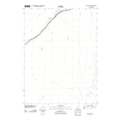
2010 Map of Castle Rock
USGS Topo · Published 2010About this map
Echo Canyon serves as the dominant geographic corridor for this portion of Summit County, carving a path through the landscape that long dictated the route of travel and settlement. The small community of Castle Rock is positioned where the canyon narrows, flanked by steep terrain and a network of drainages including Echo Creek and Robinson Creek. This area illustrates the classic Western mountain transport pattern, where modern infrastructure like the Castle Rock Frontage Rd clings to the valley floor alongside the creek. Beyond the primary transit artery, the terrain is defined by a series of isolated canyons and high-country waterways such as Stag Canyon, Ellis Canyon, and Huff Creek, showing the expansive and undeveloped nature of the Utah high country in the early 21st century.
Find a feature on this map
16 named features on this map. Tap any name to fly to it.
Don’t see what you’re looking for? This feature index may not catch every label — zoom into the map to look around manually.
Map Details
Editions of this 2010 Castle Rock Map
This is the sole edition of this map. No revisions or reprints were ever made.
Other maps of this area

1885 · Salt Lake
USGS Topo · 1:250,000

1900 · Coalville
USGS Topo · 1:125,000

1903 · Coalville
USGS Topo · 1:125,000

1954 · Salt Lake City
USGS Topo · 1:250,000

1954 · Ogden
USGS Topo · 1:250,000

1958 · Ogden
USGS Topo · 1:250,000

1958 · Salt Lake City
USGS Topo · 1:250,000

1960 · Ogden
USGS Topo · 1:250,000

1960 · Salt Lake City
USGS Topo · 1:250,000

1964 · Francis Canyon
USGS Topo · 1:24,000