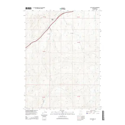
2014 Map of Castle Rock
USGS Topo · Published 2014About this map
Castle Rock stands as a prominent landmark in this section of Summit County, where the Interstate 80 corridor follows the natural passage of Echo Cr. The topography is defined by high-elevation drainage systems and deep cuts like Stag Canyon and Ellis Canyon, illustrating the high-country ranching and transit landscape of northern Utah. Human presence is centered around the transportation artery and localized access points like Aspen Meadows Rnch and Huff Creek Rd. The map detail captures the specialized nature of high-altitude water management, tracing numerous seasonal and perennial streams including Huff Cr, Cache Cave Cr, and Tristram Cr. These watercourses dictate the historical placement of roads and property boundaries across the township and range lines.
Find a feature on this map
19 named features on this map. Tap any name to fly to it.
Don’t see what you’re looking for? This feature index may not catch every label — zoom into the map to look around manually.
Map Details
Editions of this 2014 Castle Rock Map
This is the sole edition of this map. No revisions or reprints were ever made.
Other maps of this area

1885 · Salt Lake
USGS Topo · 1:250,000

1900 · Coalville
USGS Topo · 1:125,000

1903 · Coalville
USGS Topo · 1:125,000

1954 · Salt Lake City
USGS Topo · 1:250,000

1954 · Ogden
USGS Topo · 1:250,000

1958 · Ogden
USGS Topo · 1:250,000

1958 · Salt Lake City
USGS Topo · 1:250,000

1960 · Ogden
USGS Topo · 1:250,000

1960 · Salt Lake City
USGS Topo · 1:250,000

1964 · Francis Canyon
USGS Topo · 1:24,000