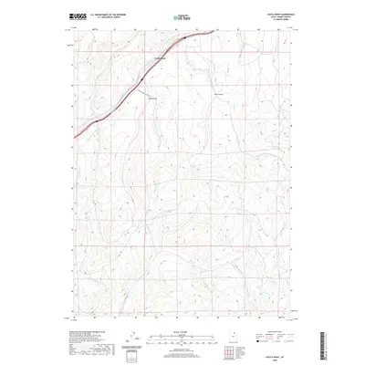
2020 Map of Castle Rock
USGS Topo · Published 2020About this map
Castle Rock serves as the primary focal point of this Summit County survey, where the topography is defined by the narrow passage of Echo Cr. This high-altitude drainage network is deeply incised by watercourses such as Rees Cr and Huff Cr, which carve through the elevated terrain to form significant landforms like Stag Canyon and Ellis Canyon. The landscape shows a distinct pattern of movement dictated by the natural corridors, with modern infrastructure following the same paths used for generations through the mountain passes.
Find a feature on this map
11 named features on this map. Tap any name to fly to it.
Don’t see what you’re looking for? This feature index may not catch every label — zoom into the map to look around manually.
Map Details
Editions of this 2020 Castle Rock Map
This is the sole edition of this map. No revisions or reprints were ever made.
Other maps of this area

1885 · Salt Lake
USGS Topo · 1:250,000

1900 · Coalville
USGS Topo · 1:125,000

1903 · Coalville
USGS Topo · 1:125,000

1954 · Salt Lake City
USGS Topo · 1:250,000

1954 · Ogden
USGS Topo · 1:250,000

1958 · Ogden
USGS Topo · 1:250,000

1958 · Salt Lake City
USGS Topo · 1:250,000

1960 · Ogden
USGS Topo · 1:250,000

1960 · Salt Lake City
USGS Topo · 1:250,000

1964 · Francis Canyon
USGS Topo · 1:24,000