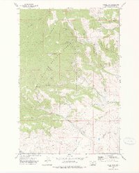
1972 Map of Castle Town
USGS Topo · Published 1975About this map
The Castle Mountains define this section of the Lewis and Clark National Forest, where a legacy of silver and lead mining is etched into the landscape. Small mining claims and established works like the Cumberland Mines, Hamilton Mine, and Yellowstone Mine are clustered along the high ridges. The settlement of Castle Town serves as a focal point for the region's history, situated near the Castle Cem and the headwaters of Castle Creek.
Find a feature on this map
35 named features on this map. Tap any name to fly to it.
Don’t see what you’re looking for? This feature index may not catch every label — zoom into the map to look around manually.
Map Details
Editions of this 1972 Castle Town Map
2 editions found
Other maps of this area

1886 · Little Belt Mts.
USGS Topo · 1:250,000

1894 · Little Belt Mts.
USGS Topo · 1:250,000

1897 · Little Belt Mts.
USGS Topo · 1:250,000

1898 · Little Belt Mts.
USGS Topo · 1:250,000

1902 · Little Belt Mts.
USGS Topo · 1:250,000

1948 · White Sulphur Springs
USGS Topo · 1:250,000

1951 · Hamen
USGS Topo · 1:24,000
1951 · Ringling
USGS Topo · 1:24,000

1951 · Rimrock Divide
USGS Topo · 1:24,000

1958 · White Sulphur Springs
USGS Topo · 1:250,000