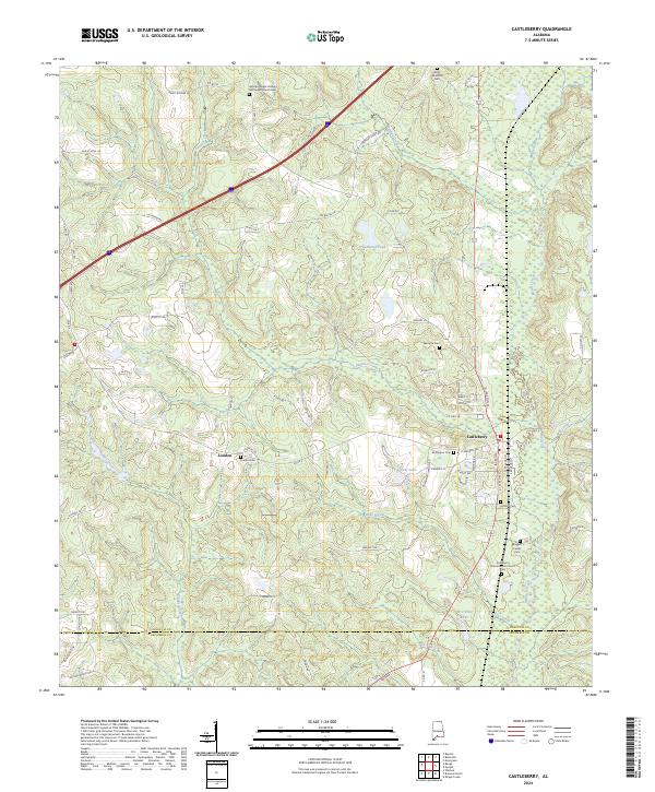
2024 Map of Castleberry
USGS Topo · Published 2024About this map
Castleberry and the small settlement of London anchor this landscape along the border of Conecuh and Escambia Counties. The area is characterized by a high density of small family and community burial grounds, such as Buffington Cem, Holland Cem, and the Baggett Family Cem, providing a detailed record of the local genealogy for researchers. Waterways like Murder Creek and Panther Creek snake through the terrain, while landmarks like Hobbs Hill rise above the surrounding creek basins.
Find a feature on this map
82 named features on this map. Tap any name to fly to it.
Don’t see what you’re looking for? This feature index may not catch every label — zoom into the map to look around manually.
Map Details
Editions of this 2024 Castleberry Map
This is the sole edition of this map. No revisions or reprints were ever made.
Other maps of this area

1953 · Andalusia
USGS Topo · 1:250,000

1957 · Andalusia
USGS Topo · 1:250,000

1960 · Brewton North
USGS Topo · 1:24,000

1960 · Wallace
USGS Topo · 1:24,000

1971 · Range
USGS Topo · 1:24,000

1971 · Castleberry
USGS Topo · 1:24,000

1971 · Belleville
USGS Topo · 1:24,000

1971 · Repton
USGS Topo · 1:24,000

1982 · Shipps Creek
USGS Topo · 1:24,000

1982 · Evergreen
USGS Topo · 1:24,000