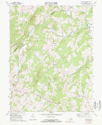
1971 Map of Castleton
USGS Topo · Published 1972About this map
Hazel River and the Thornton River define the undulating landscape of this border region between Rappahannock and Culpeper Counties. The 1971 survey reveals a territory marked by traditional rural settlements and river-based industry, most notably at Monumental Mills and the village of Castleton. The local social fabric is clearly etched in the landscape through numerous country sanctuaries such as Gourdvine Ch, Beulah Ch, and New Salem Ch.
Find a feature on this map
38 named features on this map. Tap any name to fly to it.
Don’t see what you’re looking for? This feature index may not catch every label — zoom into the map to look around manually.
Map Details
Editions of this 1971 Castleton Map
2 editions found
Other maps of this area

1887 · Spottsylvania
USGS Topo · 1:125,000

1892 · Spottsylvania
USGS Topo · 1:125,000

1892 · Gordonsville
USGS Topo · 1:125,000

1893 · Luray
USGS Topo · 1:125,000

1894 · Warrenton
USGS Topo · 1:125,000

1894 · Warrenton
USGS Topo · 1:62,500

1905 · Luray
USGS Topo · 1:125,000

1927 · Remington
USGS Topo · 1:48,000

1930 · Warrenton
USGS Topo · 1:62,500

1943 · Culpeper
USGS Topo · 1:24,000