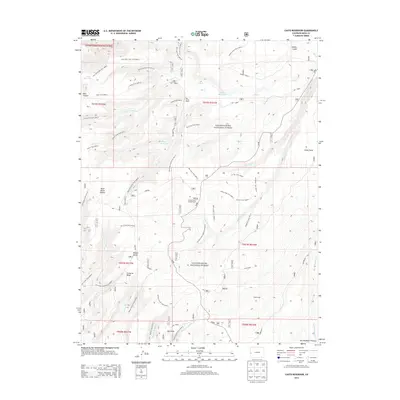
2013 Map of Casto Reservoir
USGS Topo · Published 2013About this map
The Uncompahgre National Forest dominates this section of the Uncompahgre Plateau in Mesa County, revealing a complex network of high-elevation trails and drainage systems as they appeared in 2013. The map detail highlights an environment managed for multi-use recreation and historical resource extraction, evidenced by the presence of Uranium deposits and numerous established routes such as the Ute Creek Trail 2608.0 and Gill Creek ATV Trail 2666.0.
Find a feature on this map
57 named features on this map. Tap any name to fly to it.
Don’t see what you’re looking for? This feature index may not catch every label — zoom into the map to look around manually.
Map Details
Editions of this 2013 Casto Reservoir Map
This is the sole edition of this map. No revisions or reprints were ever made.
Other maps of this area

1949 · Calamity Mesa
USGS Topo · 1:24,000

1950 · Calamity Mesa
USGS Topo · 1:24,000

1950 · Pine Mountain
USGS Topo · 1:24,000

1956 · Moab
USGS Topo · 1:250,000

1959 · Moab
USGS Topo · 1:250,000

1960 · Moab
USGS Topo · 1:250,000
1960 · Gateway
USGS Topo · 1:62,500
1960 · Pine Mountain
USGS Topo · 1:24,000
1960 · Calamity Mesa
USGS Topo · 1:24,000

1962 · Moab
USGS Topo · 1:250,000