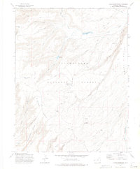
1972 Map of Casto Reservoir
USGS Topo · Published 1975About this map
Uncompahgre National Forest dominates this landscape, where the plateau terrain is defined by high-elevation features like Massey Bench and Leonards Ridge. In the early 1970s, this area of Mesa County served as a hub for both resource extraction and seasonal recreation, evidenced by the Uranium Road cutting through the western sections and the Divide Forks Campground situated near the headwaters of Big Creek. The map reveals a network of working lands and outposts, from the Big Creek Ranch to the Cold Springs Ranger Sta. Water management for the arid surroundings is central to the local geography, with Casto Reservoir and Big Creek Reservoir catching runoff from the many canyons, including Bear Canyon and Hungry Gulch. A primitive transportation network consisting of the Cabin Trail and several Jeep Trail routes provided access to landmarks like Dead Horse Pasture and Black Camp.
Find a feature on this map
37 named features on this map. Tap any name to fly to it.
Don’t see what you’re looking for? This feature index may not catch every label — zoom into the map to look around manually.
Map Details
Editions of this 1972 Casto Reservoir Map
This is the sole edition of this map. No revisions or reprints were ever made.
Other maps of this area

1949 · Calamity Mesa
USGS Topo · 1:24,000

1950 · Calamity Mesa
USGS Topo · 1:24,000

1950 · Pine Mountain
USGS Topo · 1:24,000

1956 · Moab
USGS Topo · 1:250,000

1959 · Moab
USGS Topo · 1:250,000

1960 · Moab
USGS Topo · 1:250,000
1960 · Gateway
USGS Topo · 1:62,500
1960 · Pine Mountain
USGS Topo · 1:24,000
1960 · Calamity Mesa
USGS Topo · 1:24,000

1962 · Moab
USGS Topo · 1:250,000