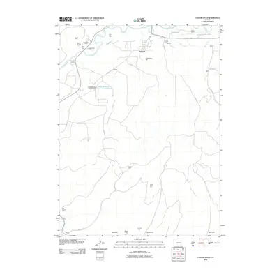
2010 Map of Castor Gulch
USGS Topo · Published 2010About this map
The Yampa River winds across the northern edge of this landscape, serving as a vital artery for the region's ranching and industrial development. Just south of the river, the residential development of Craig South Highlands sits near the Craig-Moffat Airport, reflecting the mid-century growth of this high-plateau community. The map reveals a sophisticated water management system designed to support both municipal needs and heavy industry, featuring the Deep Cut Ditch, Craig Raw Water Dam, and the Craig Holding and Evaporation Reservoir.
Find a feature on this map
44 named features on this map. Tap any name to fly to it.
Don’t see what you’re looking for? This feature index may not catch every label — zoom into the map to look around manually.
Map Details
Editions of this 2010 Castor Gulch Map
This is the sole edition of this map. No revisions or reprints were ever made.
Other maps of this area

1910 · Danforth Hills
USGS Topo · 1:125,000

1915 · Monument Butte
USGS Topo · 1:62,500

1916 · Craig
USGS Topo · 1:125,000

1916 · Daton Peak
USGS Topo · 1:62,500

1920 · Daton Peak
USGS Topo · 1:62,500

1923 · Elkhead Creek
USGS Topo · 1:62,500

1924 · Elkhead Creek
USGS Topo · 1:62,500

1954 · Craig
USGS Topo · 1:250,000

1957 · Craig
USGS Topo · 1:250,000

1958 · Craig
USGS Topo · 1:250,000