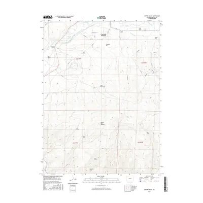
2016 Map of Castor Gulch
USGS Topo · Published 2016About this map
Craig South Highlands and the southern outskirts of Craig define the northern edge of this Moffat County landscape, where the Yampa River flows westward through Big Bottom. The 2016 survey documents a transition from the developing residential infrastructure of Wheatridge Dr and Aiken St to the significant elevation changes of the Williams Fork Mountains further south. Water management is a central theme, with the Craig Raw Water Reservoir and the winding Deep Cut Ditch supporting the region's utilities and agriculture. Aviation history is represented by the Craig-Moffat Airport situated on the northern plateau. The southern half of the map is dominated by a series of named drainages including Castor Gulch, Ute Gulch, and Horse Gulch, which carve through the high terrain between Hayden Cutoff Draw and Stock Pass Gulch.
Find a feature on this map
39 named features on this map. Tap any name to fly to it.
Don’t see what you’re looking for? This feature index may not catch every label — zoom into the map to look around manually.
Map Details
Editions of this 2016 Castor Gulch Map
This is the sole edition of this map. No revisions or reprints were ever made.
Other maps of this area

1910 · Danforth Hills
USGS Topo · 1:125,000

1915 · Monument Butte
USGS Topo · 1:62,500

1916 · Craig
USGS Topo · 1:125,000

1916 · Daton Peak
USGS Topo · 1:62,500

1920 · Daton Peak
USGS Topo · 1:62,500

1923 · Elkhead Creek
USGS Topo · 1:62,500

1924 · Elkhead Creek
USGS Topo · 1:62,500

1954 · Craig
USGS Topo · 1:250,000

1957 · Craig
USGS Topo · 1:250,000

1958 · Craig
USGS Topo · 1:250,000