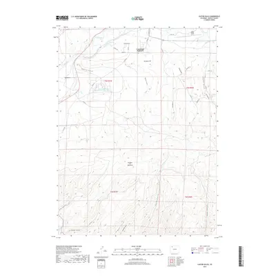
2019 Map of Castor Gulch
USGS Topo · Published 2019About this map
Craig South Highlands sits at the northern edge of this landscape, where residential expansion meets the high-country drainages of Northwest Colorado. The northern boundary is defined by the Yampa River and its associated floodplain, including the wide Big Bottom and water management features like the Deep Cut Ditch and the Craig Holding and Evaporation Reservoir. To the south, the terrain rises sharply toward the Williams Fork Mountains, a region carved by a dense network of topographic features including Horse Gulch, Stock Pass Gulch, and Castor Gulch. This 2019 survey documents a distinct transition from the transportation hub of the Craig-Moffat Airport to the working ranchlands and rugged vertical relief of the Williams Fork drainage system, illustrating the intersection of civil infrastructure and difficult high-desert terrain.
Find a feature on this map
39 named features on this map. Tap any name to fly to it.
Don’t see what you’re looking for? This feature index may not catch every label — zoom into the map to look around manually.
Map Details
Editions of this 2019 Castor Gulch Map
This is the sole edition of this map. No revisions or reprints were ever made.
Other maps of this area

1910 · Danforth Hills
USGS Topo · 1:125,000

1915 · Monument Butte
USGS Topo · 1:62,500

1916 · Craig
USGS Topo · 1:125,000

1916 · Daton Peak
USGS Topo · 1:62,500

1920 · Daton Peak
USGS Topo · 1:62,500

1923 · Elkhead Creek
USGS Topo · 1:62,500

1924 · Elkhead Creek
USGS Topo · 1:62,500

1954 · Craig
USGS Topo · 1:250,000

1957 · Craig
USGS Topo · 1:250,000

1958 · Craig
USGS Topo · 1:250,000