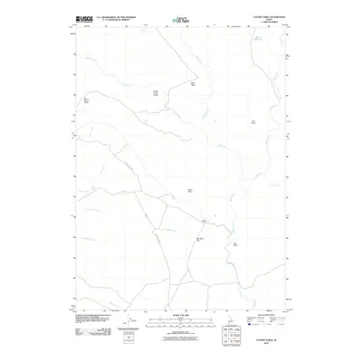
2010 Map of Castro Table
USGS Topo · Published 2010About this map
Castro Ranch sits at the heart of this high-plateau landscape in Owyhee County, where the terrain is defined by distinct flat-topped formations known as tables. The geography is marked by the prominence of Castro Table, Black Table, and Star Ranch Table, illustrating a ranching-driven land use pattern that relies on scattered water sources like Swisher Spring and Camp Spring.
Find a feature on this map
22 named features on this map. Tap any name to fly to it.
Don’t see what you’re looking for? This feature index may not catch every label — zoom into the map to look around manually.
Map Details
Editions of this 2010 Castro Table Map
This is the sole edition of this map. No revisions or reprints were ever made.
Other maps of this area

1955 · Jordan Valley
USGS Topo · 1:250,000

1957 · Jordan Valley
USGS Topo · 1:250,000

1958 · Jordan Valley
USGS Topo · 1:250,000

1973 · Red Basin
USGS Topo · 1:24,000
1973 · Wagon Box Basin
USGS Topo · 1:24,000

1973 · Smith Creek
USGS Topo · 1:24,000

1973 · Castro Table
USGS Topo · 1:24,000

1973 · Pleasant Valley
USGS Topo · 1:24,000
1973 · Dickshooter Reservoir
USGS Topo · 1:24,000

1973 · Brace Flat
USGS Topo · 1:24,000