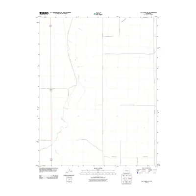
2010 Map of Cat Creek NE
USGS Topo · Published 2010About this map
Clay Creek and Horse Creek carve a winding path through the High Plains of Prowers County, defining the landscape's hydrology long before the arrival of the formal grid system. This 2010 survey by the U.S. Geological Survey shows a stark agricultural and ranching environment where the terrain is predominantly shaped by these intermittent watercourses, including Smith Arroyo in the northeast. The rural infrastructure is organized along an extensive network of straight-line section roads such as County Road U, County Road X, and County Road T. This mapping reveals how modern transport has been imposed upon the ancient drainage patterns of the eastern Colorado plains, providing a precise look at the intersection of natural geography and human boundary-making at the start of the 21st century.
Find a feature on this map
14 named features on this map. Tap any name to fly to it.
Don’t see what you’re looking for? This feature index may not catch every label — zoom into the map to look around manually.
Map Details
Editions of this 2010 Cat Creek NE Map
This is the sole edition of this map. No revisions or reprints were ever made.
Other maps of this area

1890 · Granada
USGS Topo · 1:125,000

1891 · Albany
USGS Topo · 1:125,000

1892 · Lamar
USGS Topo · 1:125,000

1892 · Granada
USGS Topo · 1:125,000

1892 · Two Butte
USGS Topo · 1:125,000

1893 · Two Butte
USGS Topo · 1:125,000

1893 · Albany
USGS Topo · 1:125,000

1894 · Granada
USGS Topo · 1:125,000

1952 · Lamar West
USGS Topo · 1:24,000

1952 · Carlton
USGS Topo · 1:24,000