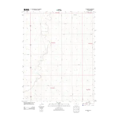
2013 Map of Cat Creek NE
USGS Topo · Published 2013About this map
Clay Cr and the intermittent drainage of Smith Arroyo define this section of the High Plains in Prowers County. The landscape is structured by a rigid grid of rural corridors, including Co Road 9, Co Road 11, and Co Road Z, which facilitate movement through the vast agricultural and grazing sections of the region. This 2013 survey illustrates the modern layout of township and range boundaries, specifically where t024s r046w meets its neighboring sections. The primary artery for north-south transit is Us-287 N, which cuts through the western portion of the quadrangle. In the southern reaches, Horse Creek winds through the terrain, further highlighting the vital, if seasonal, water systems that have dictated land use in this part of Colorado for generations.
Find a feature on this map
21 named features on this map. Tap any name to fly to it.
Don’t see what you’re looking for? This feature index may not catch every label — zoom into the map to look around manually.
Map Details
Editions of this 2013 Cat Creek NE Map
This is the sole edition of this map. No revisions or reprints were ever made.
Other maps of this area

1890 · Granada
USGS Topo · 1:125,000

1891 · Albany
USGS Topo · 1:125,000

1892 · Lamar
USGS Topo · 1:125,000

1892 · Granada
USGS Topo · 1:125,000

1892 · Two Butte
USGS Topo · 1:125,000

1893 · Two Butte
USGS Topo · 1:125,000

1893 · Albany
USGS Topo · 1:125,000

1894 · Granada
USGS Topo · 1:125,000

1952 · Lamar West
USGS Topo · 1:24,000

1952 · Carlton
USGS Topo · 1:24,000