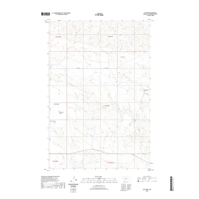
2020 Map of Cat Creek
USGS Topo · Published 2020About this map
Cat Creek serves as the primary focal point of this high-plains landscape in Petroleum County, where the settlement is situated at the intersection of Cat Creek Rd and Oil Field Rd. The terrain is defined by deep incisions from drainage systems like Long Coulee and Bull Springs Coulee, which shape the local topography. This 2020 survey records the persistent infrastructure of a region historically tied to resource extraction, as evidenced by the namesake Oil Field Rd and the network of backroads including Jitney Rd. The course of Cat Creek winds through the eastern portion of the quadrangle, carving through the township and range lines of t15n r29e and t16n r29e.
Find a feature on this map
14 named features on this map. Tap any name to fly to it.
Don’t see what you’re looking for? This feature index may not catch every label — zoom into the map to look around manually.
Map Details
Editions of this 2020 Cat Creek Map
This is the sole edition of this map. No revisions or reprints were ever made.
Other maps of this area

1954 · Jordan
USGS Topo · 1:250,000

1954 · Forsyth
USGS Topo · 1:250,000

1954 · Roundup
USGS Topo · 1:250,000

1954 · Lewistown
USGS Topo · 1:250,000

1956 · Jordan
USGS Topo · 1:250,000

1957 · Forsyth
USGS Topo · 1:250,000

1958 · Jordan
USGS Topo · 1:250,000

1958 · Roundup
USGS Topo · 1:250,000

1958 · Forsyth
USGS Topo · 1:250,000

1959 · Lewistown
USGS Topo · 1:250,000